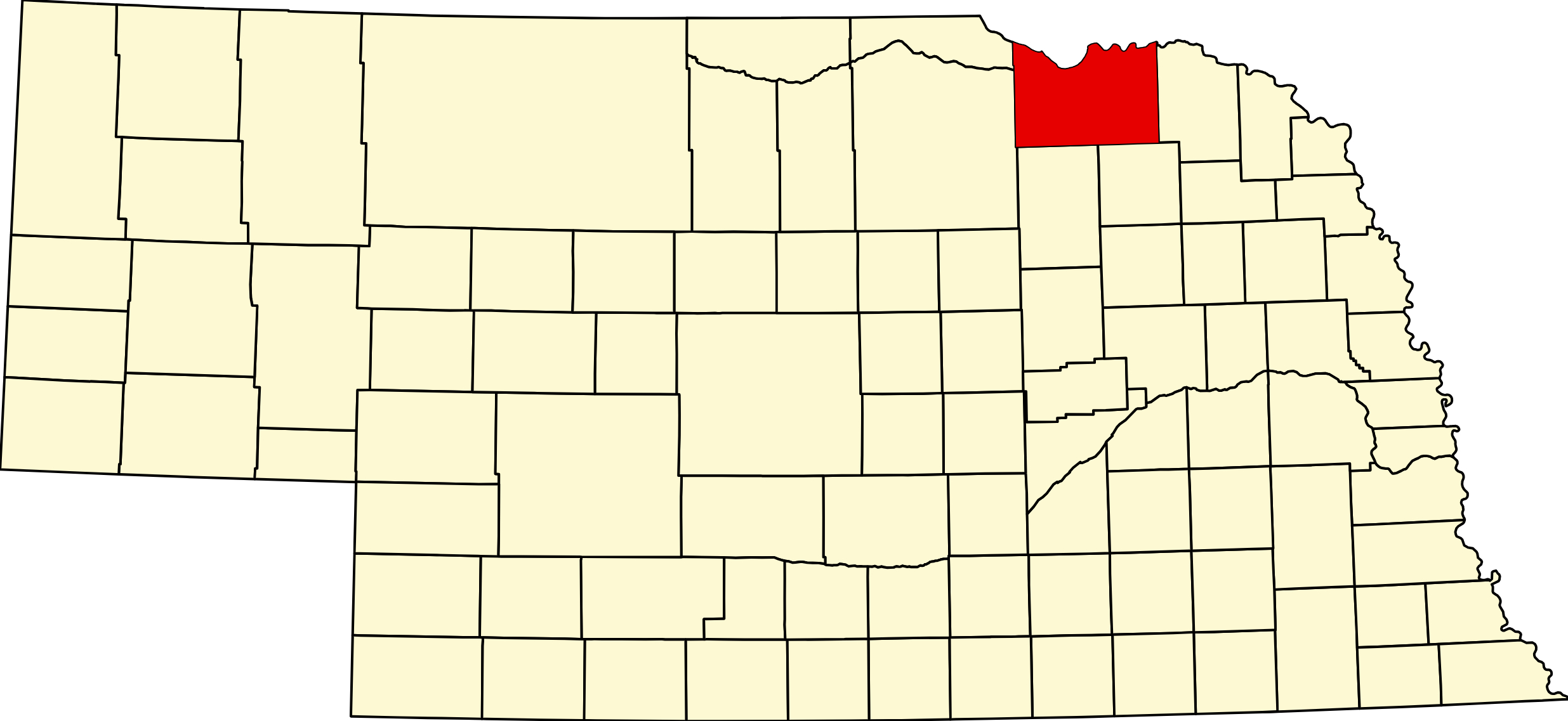
Knox County, Nebraska (Plate 12)

Knox County, Nebraska

Knox County is located in the northeastern corner of Nebraska, bordering South Dakota along the Missouri River to the north. The county encompasses 1,140 square miles of rolling prairie, wooded river bluffs, and productive farmland that has supported agricultural communities for over 165 years. Knox County is home to Lewis and Clark Lake — formed by Gavins Point Dam — and the Niobrara–Missouri River confluence, making it one of northeast Nebraska's premier outdoor recreation destinations.

The county's 16 communities range from the Czech heritage villages of Verdigre and Wausa to the historic river town of Niobrara, the outdoor recreation hub of Crofton, and the Santee Sioux Nation along the Missouri River. The county seat is Center, one of the smallest county seats in Nebraska by population. Creighton, the county's largest city, serves as the commercial and healthcare hub, anchored by Avera Creighton Hospital.

Knox County is crossed by U.S. Highway 20 (east-west through Bloomfield and Creighton), Nebraska Highway 12 (the Lewis and Clark Highway along the northern Missouri River corridor), and Nebraska Highway 84 (north-south through Center and Creighton). The county is part of the Northeast Nebraska (Lewis & Clark) region.

Towns in Knox County

Browse all Knox County towns: Knox County Towns →

Creighton, Nebraska 68729

Knox County's largest city on US-20 and NE-84. Named for telegraph pioneer Edward Creighton; home of Avera Creighton Hospital and the Knox County Fair.

Pop: ~1,174 | Highways: US-20, NE-84 | Designation: City

Town Page · Cameras

Bloomfield, Nebraska 68718

City on US-20 in western Knox County. Agricultural hub with West Knox Public Schools serving the western county.

Pop: ~1,023 | Highways: US-20, NE-84 | Designation: City

Town Page · Cameras

Crofton, Nebraska 68730

Village near Lewis and Clark Lake — Knox County's outdoor recreation gateway for walleye fishing, boating, hunting, and camping on NE-12.

Pop: ~721 | Highways: NE-12, NE-121 | Designation: Village

Town Page · Cameras

Santee, Nebraska 68760

Home of the Santee Sioux Nation (Niobrara Reservation) along the Missouri River bluffs on NE-12. One of northeast Nebraska's most historically significant communities.

Pop: ~714 | Highways: NE-12 | Designation: Village

Town Page · Cameras

Wausa, Nebraska 68786

Village with Czech and Bohemian heritage in eastern Knox County on NE-57. Part of the Czech cultural corridor of northeast Nebraska.

Pop: ~575 | Highways: NE-57 | Designation: Village

Town Page · Cameras

Niobrara, Nebraska 68760

Historic village at the Niobrara–Missouri River confluence. Gateway to Niobrara State Park and the Lewis and Clark National Historic Trail on NE-12.

Pop: ~356 | Highways: NE-12, US-281 | Designation: Village

Town Page · Cameras

Verdigre, Nebraska 68783

Czech Kolach Capital of Nebraska on US-20. Home of the World's Largest Kolache and the annual Kolach Days festival celebrating Czech heritage.

Pop: ~298 | Highways: US-20, NE-39 | Designation: Village

Town Page · Cameras

Center, Nebraska 68724

County seat of Knox County on NE-84. Home of the Knox County Courthouse; one of the smallest county seats in Nebraska by population.

Pop: ~76 | Highways: NE-84 | Designation: Village, County Seat

Town Page · Cameras

Winnetoon, Nebraska 68789

Small village on NE-14 south of Creighton. One of the "planet communities" of Knox County, near Mars and Venus.

Pop: ~62 | Highways: NE-14 | Designation: Village

Town Page · Cameras

Verdel, Nebraska 68760

Small village on NE-12 between Niobrara and Boyd County, along the Missouri River bluffs Lewis and Clark Highway corridor.

Pop: ~41 | Highways: NE-12 | Designation: Village

Town Page · Cameras

Bazile Mills, Nebraska 68729

Small village on NE-84 north of Creighton, named for Bazile Creek. Near Bazile Creek State Wildlife Management Area.

Pop: ~59 | Highways: NE-84 | Designation: Village

Town Page · Cameras

Lindy, Nebraska 68760

Census-designated place near Niobrara in the northern Knox County Missouri River corridor on NE-12.

Town Page · Cameras

Mars, Nebraska 68789

Small unincorporated community in south-central Knox County on NE-14, one of the "planet communities" near Winnetoon and Venus. ZIP: 68789.

Town Page · Cameras

Venus, Nebraska 68789

Small unincorporated community near Winnetoon and Mars in south-central Knox County. ZIP: 68789.

Town Page · Cameras

Pischellville, Nebraska

Small unincorporated community in interior Knox County on NE-84 near Center.

Town Page · Cameras

Saint Charles, Nebraska

Small unincorporated community in northern Knox County along the NE-12 Missouri River corridor near Niobrara.

Town Page · Cameras

Knox County Cameras

View live cameras along NE-12, US-20, and the Missouri River corridor in Knox County.

Knox County Cameras →

Travel Corridors

U.S. Highway 20 — East-west through Bloomfield, Creighton, and Verdigre connecting northeast Nebraska. US-20 Corridor →

Nebraska Highway 12 (Lewis and Clark Highway) — Along the northern Missouri River corridor through Niobrara, Santee, Verdel, Lindy, and Crofton. NE-12 Corridor →

Nebraska Highway 84 — North-south through Center, Creighton, and Bazile Mills.

Knox County Business Directory

Find restaurants, lodging, health services, and local businesses across Knox County.

Browse Knox County Directory →

Creighton Area Listings · Crofton Area Listings · Niobrara Area Listings · All Listings

Region & Adjacent Counties

Region: Northeast Nebraska (Lewis & Clark)

Adjacent Counties:
Cedar County (east) · Pierce County (southeast) · Antelope County (south) · Holt County (west) · Boyd County (northwest)

Knox County also borders South Dakota: Bon Homme County (north), Yankton County (northeast), Charles Mix County (northwest).

KNOX COUNTY WEATHER

County Seat: Center
Founded: Created as L’Eau Qui Court, February 10, 1857; renamed Knox in the early 1870s
Named For: Major General Henry Knox, first United States Secretary of War
License Plate Prefix: 12
Population: 8,391 (2020 census)
Area: 1,139 sq mi

History

Knox County was created in 1857 as L’Eau qui Court County — French for “running water”, the old name for the Niobrara — and renamed in 1873 for General Henry Knox, the first United States Secretary of War. Niobrara, at the mouth of the river, is one of the oldest settlements in Nebraska, and the town has been moved twice because of flooding, most recently in the 1970s when the rising bed of Lewis and Clark Lake forced it uphill.

The county seat is Center, and its name is its explanation: it was chosen because it sat in the middle, after a forty-year argument with Niobrara, Creighton and Verdigre. Czech and Bohemian settlers gave Verdigre its lasting character, and the Santee Sioux Reservation occupies the county’s north-east corner.

The Ponca homeland lay in what is now Knox County, along Ponca Creek and the Missouri. In 1877 the tribe was forced south to Indian Territory; the Ponca Tribe of Nebraska has its headquarters at Niobrara today. See the Ponca Trail of Tears.

Geography

Knox County covers about 1,140 square miles along the Missouri River in the far north-east of the state. The Missouri forms the northern boundary with South Dakota, and the Niobrara enters it here at one of the last free-flowing, unchannelised reaches of the river. Gavins Point Dam backs the water up into Lewis and Clark Lake, Nebraska’s second-largest reservoir. Inland it is rolling farmland cut by Bazile Creek and Verdigre Creek. It borders Boyd County to the west, Holt County and Antelope County to the south-west, Pierce County to the south and Cedar County to the east.

Outdoors — Camping, RV, Hunting & Fishing

Knox County is the strongest water-recreation county in north-east Nebraska, with two state areas and a long Missouri River frontage.

Camping and RV

Niobrara State Park — 89261 522 Avenue, Niobrara. 1,236 acres above the Niobrara-Missouri confluence. Electric Plus sites plus about thirty basic non-electric, and equestrian camping on 120 acres of free range with a corral. Reported at 30- and 50-amp with a maximum rig length of 55 feet. Dump and fill station on site. Water is from scattered faucets — there are no individual water hookups, so bring a long hose. Modern restrooms and coin-operated showers, closed roughly mid-October to April. Nineteen cabins. Swimming pool mid-June to mid-August.

Lewis and Clark State Recreation Area — 54731 897 Road, Crofton. Nebraska’s second-largest reservoir, fifteen miles long. Five areas — Weigand, Burbach, Miller Creek, Bloomfield and South Shore — with over 150 electric sites and more than 100 basic, in every category from full hookup to equestrian, at 30 and 50 amp. Ten modern two-bedroom cabins. The dump station is in the Burbach area: if you are camped at Miller Creek, Bloomfield or South Shore you will drive to it. Modern facilities run April to October.

Weigand Marina is closed through 2026 for a multi-year upgrade, though the store remains open — do not count on renting a slip. Bloomfield has had tree-removal work in the autumn.

Verdel River Access, a National Park Service site on the Missouri, has a boat ramp, accessible restroom, potable water and primitive camping, free. Bloomfield, Creighton, Wausa, Verdel, Niobrara, Verdigre and Santee all have municipal or private campgrounds; the county publishes names and numbers but not hookup detail, so ring ahead.

One to know: Nebraska Tailwaters Campground, below Gavins Point Dam, is in Cedar County, not Knox, despite Crofton addressing.

Fishing

Lewis and Clark Lake holds walleye, sauger, largemouth and smallmouth bass, bluegill, crappie, catfish and white bass. Four boat ramps in the Weigand area; jetties give bank access; one fish-cleaning station. No-wake in the spillway portion and the Gavins Point tailrace. The lake and the Missouri are border water with South Dakota — confirm current reciprocity with both states before fishing from a boat.

The lower Niobrara at Niobrara State Park gives walleye, sauger, smallmouth bass, catfish and northern pike. A park entry permit is required at both state areas, on top of a fishing permit — including just to launch. Bazile Creek WMA and Verdel need no entry permit.

Hunting

Bazile Creek WMA is the big one, roughly four miles east of Niobrara where Bazile Creek meets the Missouri — riparian and grassland, deer, pheasant, turkey and waterfowl, with a boat ramp off 528 Avenue. Published acreage varies widely between sources; check the Public Access Atlas.

Unusually for a state recreation area, Lewis and Clark is open to hunting from the Tuesday after Labor Day — upland, big game and waterfowl — but special regulations apply in the Weigand and Burbach areas, so read the posted signs.

Trails and the byway

Niobrara State Park has fourteen miles of hiking, equestrian and biking trail including a two-mile hike-bike route. Lewis and Clark has four and a half miles from the South Shore area, plus disc golf at Weigand-Burbach.

The Outlaw Trail Scenic Byway — which is Nebraska Highway 12, not US-20 — runs 231 miles from South Sioux City to Valentine, crossing the county between Niobrara and Crofton.

Events

The Knox County Fair at Bloomfield anchors the summer. Verdigre Kolach Days celebrates the county’s Czech heritage and draws visitors from well beyond the county line.

Dates move year to year, so they are kept with the listings rather than repeated here.

Browse event listings in Knox County →
Submit an event or correction →

Knox County at a Glance

Knox County, Nebraska — about 1,140 square miles along the Missouri River in the far north-east, where the Niobrara joins one of the last free-flowing reaches of the Missouri. County seat Center, so named because it sat in the middle of a forty-year county-seat argument. 485 listings across 16 towns.

Getting there: NE-12, the Outlaw Trail Scenic Byway, runs the length of the county through Niobrara and Crofton; NE-13 and NE-14 cross north to south; US-20 lies just south.

For visitors: Lewis and Clark State Recreation Area, Nebraska’s second-largest reservoir, with over 250 campsites and ten cabins; Niobrara State Park above the confluence, with nineteen cabins and fourteen miles of trail; Verdigre’s Czech heritage; and the Santee Sioux Reservation in the north-east.

Knox County · Northeast Nebraska · County Cameras